Help: How to use AtlasFor
The Atlas AtlasFor is a web platform which proposes a sophisticated system of crossed filters. On this page, you can discover how to use them.
Left sidebar
Highlights
We prepared some ready to use visuals in the highlights. Choose a filter by opening a shelf and clicking on its image.
Territories
This tool modifies the visualisation and allows you to reach a specific place.
Archives
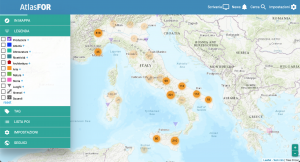
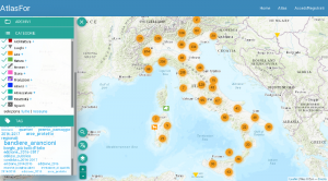
We pride ourselves on having an extensive organization of different themes addressed by points of interest and their multimedia files in various Archives. Try exploring different Archives and enabling some of them to discover all the thematic areas.
Categories
If the Archives are thematic filters, Categories are functional ones. Choose among the categories if you only want to see parks, museums, or both, etc.
Tag
Depending on the visualization, you will see all the Tag of the points of interest and their multimedia files in the area.
Clicking on a Tag you will only see the material related to that Tag.

