Introduction to AtlasFor
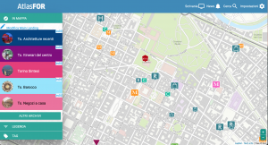
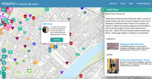
AtlasFor is an online web-app created by the LandscapeFor cultural Association, where points of interest (POI) and their fact sheets are georeferenced.
Indice
Introduction to AtlasFor
The platform
AtlasFor is a free access platform for browsing on any type of device in a simple way, offering advanced research options dedicated to specialistic topics in the field of cultural and social heritage.
The AtlasFor atlas is fully accessible by using a free software on the user's device, which was developed with full support to LibreJS.
Useful images for tours and points of interest factsheets
Thanks to the sorting of iconographic materials based on their georeferencing on the map, contents are accessible by mobile devices in the same area: an unprecedented service for curious visitors and students.
Every POI comes with a folder of images and short videos with short captions documenting its chapters with an innovative visual storytelling: history, projects, events, context, explanations, and stories.
The APPA programme on AtlasFor
APPA - Atlas of the Heritage and the "Active landscape" (parties and initiatives aimed at enhancing and preserving tangible and intangible landscapes) - is AtlasFor populating programme dedicated to territories surrounding Italian UNESCO Sites.
AtlasFor editorial staff
Taking part in editing APPA and presenting your work
The LandscapeFor Associations offers the parties of the "Active Landscape" the chance to take part in APPA as authors: with AtlasFor you can draft POI factsheets with your own account, with the help of our tutors and the validation of the editorial committee.
The parties offering services or expression activities of the intangible landscape can use AtlasFor to showcase their initiatives through original iconographic materials.
Presenting your research with original materials
Researchers and parties of the "Active landscape" who want to promote heritage can use AtlasFor as an innovative tool to create, update and publish their studies using images or videos.
Sorting iconographic materials on a geographical basis is very useful for researchers, who can publish little-known content like photos, videos, interviews, grey literature and audio files in an easy and affordable way.
How to draft a POI factsheet
Drafting a POI factsheet is easy. From your "Dashboard" draft the POI identity card with its localization and general description and affiliate it to the "Categories" and "Archives".
To know more about how to draft a POI factsheet see How to draft a POI factsheet.
What's a Media
Media are illustrated pages making up the POI factsheet. They consist of photos, videos or GIFs. Files are conformed to a standard and added to the chapters of the POI story, with short descriptions and thematic tags.
To known more about how to draft a media, visit Media.
Authors and sources
Every media includes both the authors of the POI factsheet and the origins of the multimedia files, and the digital and physical sources of the materials.
Research editors
Writers and editorial staff
Every editor of the "Active landscape" is given a "Dashboard" to draft POI factsheets, media, draft reports, in an ongoing dialogue with AtlasFor editorial staff, who verifies and enables users to publish complete and correct factsheets.
Research and group editing
For shared research projects among different users, the editorial staff can create upon request a work group for users to share materials and work together.
The work group can have a "Tutor" who can remotely intervene on other participants' work, suggest necessary corrections and reference the models of the Editorial staff.
Services for AtlasFor editors
Training tutorial and wiki
The LandscapeFor association provides a 4-hour training, a series of tutorials and a wiki to introduce the complete use of AtlasFor operational tools to new editors.
Per i tutorial puoi visitare il nostro canale di YouTube
Review and translation
AtlasFor editorial staff, supported by the scientific committee and together with the local referents of every territory reviews the POI factsheets to publish and, if missing, the translation into English or French.
News
The ""News"" service is available to the parties of the "Active landscape" promoting events and initiatives, to automatically copy every future event on their POI factsheet.
Repository
Editors and groups are provided with a repository to upload rough iconographic material while waiting for the creation of a media. Access to the repository can be limited to the editor only, their group and other groups.
Output with report
A set of selected POIs and media can be edited in .pdf format for educational, personal or touristic purposes.
Output with article on the AtlasFor Magazine
"AtlasFor Magazine" is a registered periodical reporting updates on the APPA project and other AtlasFor initiatives. A scientific committee defines the eligibility criteria for publications.
A selected set of POIs and media can be edited and presented with a dedicated article on AtlasFor Magazine.
AtlasFor for education
Education with AtlasFor
Thanks to the creation of groups followed by tutors, together with editor services (training, review, material repository, report etc.), AtlasFor is an easy-to-use tool for fieldwork for university courses, theses or school projects.
By creating separate groups, teachers can manage, correct and assess their students work based on the creation of a folder on a specific research topic, asking to publish the completed and correct parts on APPA.
Internships at LandscapeFor
The LandscapeFor Association has agreements with universities for internships dedicated to research and editing methodologies for the digitalization of the cultural heritage, and the participation in the APPA project with materials provided by the universities.

